Magnetic Island Nature Care Association
  • Home
  • Donations
  • About
    • History of MINCA
    • Become A Member
    • Renew Your Membership
  • Resources
    • World heritage Values of Magnetic Island
    • Plants of Magnetic Island
    • Weeds of Magnetic Island
    • Favourite Trees
    • Native animals of Magnetic Island
    • Birds of Magnetic Island
    • Butterflies of Magnetic Island
    • Reptiles of Magnetic Island
    • Frogs (Amphians) of Magnetic Island
    • Spiders, Insects & Bugs of Magnetic Island
    • Life in the ocean around Magnetic Island
    • The geology of Magnetic Island
    • Library & Links
  • Projects
    • Caring for the West Point Road
    • Bolger Bay Conservation Park
    • Protection of Radical Bay
    • Townsville Port expansion >
      • Flyer
    • Clear Water Townsville >
      • The Future of Cleveland Bay >
        • Historical Impacts of Silt Pollution
      • The Story So Far
      • Cleveland Bay: Current & Impacts
      • The Impact of Dredging
      • Dolphins, Dugongs & Turtles
      • Where Have All the Fish Gone?
      • Proposed Port Expansion & Master Plan
      • Port of Townsville's Changing Plans
      • How Many New Berths?
      • Big Enough Already!
      • Jobs and the Port
      • The $1.64 Billion Quesion: WHY?
      • Contact Clear Water Townsville
    • Freecycle
  • Achievements
    • Claude's Block
    • 2011 Anti-plastic Bag Campaign
    • 2011 Short Film Competition
    • 2010 Low Carbon Diet Inter-Bay Challenge
    • 2010 'Carbon Cuts' Film Competition
    • 1996 Nelly Bay Habitat Reserve
    • ARCHIVE NEWS
  • Gallery
  • Contact
  • Activities

Magnetic Island's World Heritage values

Our World Heritage Island

The Commonwealth Government nominated the Great Barrier Reef for inclusion in the World Heritage List in 1981 for its “outstanding universal values”, both natural and cultural.

It was inscribed on the World Heritage List that same year. At the time the International Union for the Conservation of Nature wrote "... if only one coral reef site in the world were to be chosen for the World Heritage List, the Great Barrier Reef is the site to be chosen”.

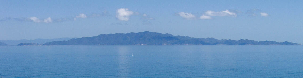
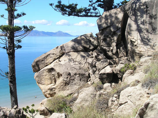
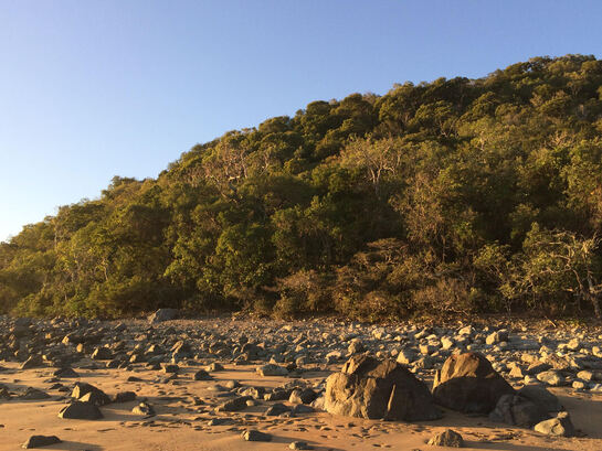
Its values were summarised as:
  • superlative natural beauty above and below the water
  • a globally outstanding example of an ecosystem that has evolved over millennia
  • a globally significant diversity of reef and island morphologies reflecting ongoing geomorphic, oceanographic and environmental processes.
  • its enormous size and diversity means it is one of the richest and most complex natural ecosystems on earth, and one of the most significant for biodiversity conservation.... supporting tens of thousands of marine and terrestrial species.
The GBRWHA is defined by an outside boundary, and includes over 900 islands.  The 99% of the enclosed area that is sea is also mostly Marine National Park. The Great Barrier Reef Marine Park extends to the low water mark, while the area between low and high tide marks are within the Great Barrier Reef Coast Marine Park. Excluded areas such as defined port areas are not Marine Park but are still part of the World Heritage Area.

Responsibility for the protection and management of the World Heritage Area generally lies with the Commonwealth and State Governments. This is particularly true for Magnetic Island where QPWS is the largest land manager.

However Magnetic Island is unusual in being the World Heritage Area’s most urbanised island. As the next largest land manager, and the decision maker for most development proposals, Townsville City Council also has a major role in the protection of values remaining in the island’s urban areas. The local community also has a role, particularly in minimising their day-to-day impacts on values, and contributing to the restoration of degraded areas.

The World Heritage Area covers about 348,000 km2 so the identified values in the listing are general and not directly related to specific areas.

Picture
Photo: George Hirst
There have been two significant attempts to identify natural and cultural values specific to the island:
  • A community based assessment by island resident scientists (Magnetic Island’s World Heritage Values: A Preliminary Assessment, MICDA and MINCA 2004)
  • A subsequent study by consultants to the Federal Government (World Heritage Attributes and Values Identified for Magnetic Island and the Surrounding Marine Environment, Kenchington and Hegerl 2005)
Following these studies the Commonwealth produced a policy to help determine which of the island’s World Heritage Values were matters of National Environmental Significance under the national Environment Protection and Biodiversity Conservation Act, and what actions might need to be referred for assessment and approval (Magnetic Island, Queensland Region EPBC Act policy statement 5.1, 2010).  This policy is only concerned with actions that would have a “significant” impact on values. In practice it allows the continuing incremental loss of values, and provides no guidance for better management or restoration of values.

Picture

In the developed parts of the Island, these questions arise:


1. To what extent do values remain, and what are they?


2. What impacts are existing developments and uses having,
and can these impacts be reduced?


3. What can we do to maintain, restore or increase remaining values?


A series of community-based workshops was run by The Great Barrier Reef Foundation in 2020 to develop a Community Action Plan to help the island community to protect and monitor the islands cultural and natural values.

The workshops gave highest priority to a project that would identify these values, and what the community could do to protect or improve them. This project, the Magnetic Island World Heritage Values Project, was developed by MINCA and subsequently funded through the Great Barrier Reef Foundation. It is currently underway and due to be completed by mid 2023.

The Magnetic Island World Heritage Values Project will build a comprehensive knowledge base by mapping and describing the island’s marine and terrestrial natural features and values using existing and new scientific, local, and traditional knowledge. This will update the current knowledge and enable the island community to identify the natural values needing protection, and the best way to reduce any threats.

The first stage is to collate existing knowledge through review and expert workshops. Expert workshops with island marine and terrestrial scientists have been held and the outcomes are currently being collated. This information will then be reviewed through public workshops, and targeted survey undertaken of areas where more information is needed.

The final results of the project will be made widely available through web-based applications as well as being distributed as an information package for residents and visitors. The clear identification of values, needs and priorities will ensure the project has enduring outcomes that can be furthered by Council and the island community.

Our World Heritage Marine Environments

Magnetic Island is one of over 900 islands within the Great Barrier Reef World Heritage Area. Each feature of the World Heritage Area - be it the coral reefs, mangrove shorelines, seagrass beds, birdlife roosting in island vegetation or the freshwater creeks that disperse sand and nutrients into the water – each contributes in different ways to the values that resulted in its World Heritage listing. No other World Heritage property contains the amount of geological and biological diversity that we find in the Great Barrier Reef area.

Magnetic Island is a unique part of the Great Barrier Reef, not because of one or other rare plant or animal, but because we have so many of the Reef’s physical and living systems all focused in a limited geographical area. There’s nothing like it!

Many coastal systems
Everyone knows our sandy beaches. Those beaches are supported by seasonal creeks with mangrove-lined tidal lagoons and sand-dunes above the highest tides. This can be easily seen in Horseshoe Bay. On the eastern side of the island, shores of chaotic massive granite boulders protect the island from wave action – nothing quite like them can be seen elsewhere on the Reef’s islands. In the west, an extensive mangrove system lines the coast and provides a home for many species of birds, molluscs, fish and reptiles. Over 10 species of mangrove surround samphire mudflats and other saline ecosystems. Between West Point and Five Beach Bay the coastline changes dramatically to volcanic rock, the remnants of the landscape that predates our granites.

Under the water
The Island’s fringing reefs are a source of wonder for visitors and scientists alike. Coral spawning was first witnessed globally by scientists in Geoffrey Bay. Coral communities of different compositions can be viewed in shallow waters all around the Island (there are at least 9 different reefs). The Island’s reefs are closely linked to the adjacent bays and so the coral species found there have adapted to high levels of seasonal freshwater and exposure to sediment and nutrient runoff (unlike the corals further from the coast). One example of such coral is Montipora digitata – we have the most extensive colony on the Great Barrier Reef. In Florence Bay a rare deep water soft coral has been found and is not seen anywhere
else. The massive and ancient Porites corals in our fringing reefs have provided climate data going back hundreds of years.

Seagrass beds are of great importance to many animals including dugongs and turtles. Around the Island we have 11 different species of seagrass with another that is possibly unique to the Island’s waters. Seagrass beds and the inter-tidal mudflats (mainly between Cockle Bay and West Point) also support bird species such as waders, many fish species, crustaceans, shellfish and squid.

Our big animals
Our dugongs are well known but their population is threatened due to habitat loss. The Island is within a dugong protection area. You can see flatback or green turtles in most bays when they come up to breathe and if you’re lucky, you might witness a turtle coming ashore to make a nest and lay her eggs.  The Island is an important turtle nursery. During the winter months, we have many species of whales (eg., humpbacks and pilot whales) that pass by and can be seen breaching as they go. Sharks are important apex predators and are part of the balance within our marine ecosystems. The north-eastern side of the Island is considered to be a tiger shark nursery. A court has recently found that tiger shark numbers are in decline partly as a result of tiger shark culling under the Queensland shark control program.

Indigenous history
Many sites on the Island show a long history of use of marine resources by indigenous communities. There are middens (large piles of opened seashells such as cockles and oysters) in the sand dunes of a number of bays and even some at elevation along seasonal creeks. Evidence of fish traps have been found on the western side of the island.

So much more to learn
Although we know a lot about our Island’s marine environments, there is a lot we are yet to discover. We will only make those discoveries if we preserve what we have for future generations.

Threats to our marine environments and our World Heritage status
Reducing our environmental impacts is the key to preserving our marine environments. Threats include:
• Use of septic tanks which discharge into the ground water
• Use of chemicals such as fertilizers, cleaning agents, pesticides and herbicides, which are flushed by rain into the nearest bay
• Illegal fishing in green zones, as well as fish feeding by visitors in these zones
• Silt from channel dredging landing on our reefs and other marine environments
• Erosion and sediment runoff as a result of poor land management and inadequate vegetation cover
• Drumlines, which kill sharks and other large marine animals
• Vehicles driving on beaches and mudflats, and uncontrolled dogs.

Our World Heritage Island Terrestrial Environments

Ever wondered why the Great Barrier Reef World Heritage Area includes waters where there are no reefs, and islands as well? It is because the entire area, with all its different features, is crucial to the functioning and survival of the reefs that make our Barrier Reef Great. Islands, including Magnetic Island, provide nesting areas for turtles and sea birds, as well as protection and shallows for smaller and different reef systems. The health of the marine environments can be directly linked to what happens on the land and so islands like Magnetic Island are part of the
fabric of the greater ecosystem that we call the Great Barrier Reef.

The Great Barrier Reef was listed as a World Heritage property because of its beauty and incredible diversity. The terrestrial environments of Magnetic Island make a substantial contribution to these values.

What is our Island made of?
Over 250 million years ago the granite boulders that we see in every view of the Island were molten rock beneath the Earth’s surface. It cooled and cracked, and wind and water erosion over many thousands of years revealed and shaped them, and at the same time created our beaches and the sandy soils that support the Island’s vegetation. Those processes continue today. The south-easters have hewn granite sculptures in Rocky Bay, for example, and occasional wet season landslides release decomposed granite onto the lowlands.

A very different kind of rock can be seen from West Point to Five Beach Bay. These are the “Julago Volcanics”, very fine-grained rocks older than the granite boulders we see everywhere else. In some bays you will find a dark-grey or olive coloured rock in bands within the granite. This is dolerite – a volcanic “basalt” which in molten form pushed its way into cracks in the granite and cooled underground.

Picture
Magnetic's distinctive granite above Rocky Bay
Picture
'Julago volcanics' at West Point
                           

But it is the Magnetic Island granite, the climatic forces at work here, and the impact of the surrounding seas, that have given the Island its distinctive appearance. The Island was separated from the mainland by rising seawater about 6,000 years ago, following the last glacial period.

Our island landscapes
Have you ever looked up at Mount Cook (493 metres) and wondered what the landscape is like up there? The altitude makes it cooler and moister so there is a unique Island landscape with palms and she-oaks, but it is only one of 29 different ecosystems identified on the Island.

The diversity of the Island’s landscapes is remarkable. Consider that we have all these and more on one island:
• Rugged hills and sheltered gullies, with mahogany woodlands, kapok and wattle covered rock sheets, vine thickets, and Hoop Pine forests on rocky headlands. Thirteen different ecosystems have been identified in the hills, most of which are in the national park.
• Mixed Eucalypt woodlands on foot slopes and flood plains on the lowlands (now substantially affected by urban development but largely intact on the western side of the Island)
• Beaches and dune systems, including nationally endangered coastal vine thickets in Nelly Bay Habitat Reserve and Horseshoe Bay.
• Seasonal freshwater watercourses and wetlands (such as we have in Horseshoe Bay and Cockle Bay).
• Extensive and diverse mangrove forests and other tidal ecosystems on the western side of the Island

The Island’s plants
578 native plant species have been identified on the Island, and others continue to be found. Some are iconic such as the Kapok with its beautiful yellow flowers and the Hoop Pines that shelter from fire in rocky outcrops. In the lowlands, some Poplar gums remain – the hollows in the older trees are nests for insectivorous bats, rainbow lorikeets, galahs and cockatoos. On the beaches, she-oaks, fan-flowers, jack bean and beach almond hold the beach front together and create habitat for numerous animals.

Picture
Undescribed Tephrosia at Picnic Bay


Some plants are listed as endangered and some a have a very small range, mostly limited to the Island. We have a rare wattle (Acacia jackesiana) that few people have seen, as well as an undescribed Tephrosia species, a small silver-leaved shrub that seems to grow only on Hawkings Point. A 1990 survey of the Island’s plants found 10 that could be new species. All these plants have their own preferred habitats so face particular threats.

The Island’s land animals
The Island’s celebrity animal would have to be the Koala. The Island is a refuge for Koalas but also for many others such as migratory birds: waders, imperial pigeons, cuckoos, dollar birds and terns. 146 native bird species have been recorded on the Island. The blue tiger butterflies find a place to rest in our shady vine thickets, before they start the next part of their journey. Some of our animals, especially birds such as the white – breasted sea eagle and the brahminy kite, are largely dependent on what they can catch from the Island’s waters. Many reptiles and insects rely on our urbanised lowlands, creeks and lagoons, but they are still poorly known. We know of only one animal that has become extinct on the Island, the northern quoll, although the apparent absence of small native animals suggests there have been other extinctions. Once the island becomes cat-free it has the potential to become an “island ark” where some of these smaller animals can be re-introduced.

Indigenous history
People often ask, is there Aboriginal rock art on the Island? The answer is yes there is, but its location is a well-kept secret. A number of burial sites have also been found on the Island and documented by Traditional Owners and archaeologists. There are also middens, remains of old camp sites where shells show past use.

Threats to our terrestrial environments and our World Heritage values
Controlling our environmental impacts is the key to preserving our land environments. The threats include:
• Vehicles driving on beaches and mudflats
• Further clearing of lowland areas, and removal of significant trees
• Invasion of weeds such as lantana, guinea grass, stylo, and siam weed
• Wandering dogs and cats
• Poor fire management
• Native animal mortality from speeding vehicles and poisoning, particularly by rodenticides.
  • Home
  • Donations
  • About
    • History of MINCA
    • Become A Member
    • Renew Your Membership
  • Resources
    • World heritage Values of Magnetic Island
    • Plants of Magnetic Island
    • Weeds of Magnetic Island
    • Favourite Trees
    • Native animals of Magnetic Island
    • Birds of Magnetic Island
    • Butterflies of Magnetic Island
    • Reptiles of Magnetic Island
    • Frogs (Amphians) of Magnetic Island
    • Spiders, Insects & Bugs of Magnetic Island
    • Life in the ocean around Magnetic Island
    • The geology of Magnetic Island
    • Library & Links
  • Projects
    • Caring for the West Point Road
    • Bolger Bay Conservation Park
    • Protection of Radical Bay
    • Townsville Port expansion >
      • Flyer
    • Clear Water Townsville >
      • The Future of Cleveland Bay >
        • Historical Impacts of Silt Pollution
      • The Story So Far
      • Cleveland Bay: Current & Impacts
      • The Impact of Dredging
      • Dolphins, Dugongs & Turtles
      • Where Have All the Fish Gone?
      • Proposed Port Expansion & Master Plan
      • Port of Townsville's Changing Plans
      • How Many New Berths?
      • Big Enough Already!
      • Jobs and the Port
      • The $1.64 Billion Quesion: WHY?
      • Contact Clear Water Townsville
    • Freecycle
  • Achievements
    • Claude's Block
    • 2011 Anti-plastic Bag Campaign
    • 2011 Short Film Competition
    • 2010 Low Carbon Diet Inter-Bay Challenge
    • 2010 'Carbon Cuts' Film Competition
    • 1996 Nelly Bay Habitat Reserve
    • ARCHIVE NEWS
  • Gallery
  • Contact
  • Activities